Summary of climate disasters on the planet, July 30—August 5, 2025
The M8.8 earthquake that struck Kamchatka on July 30 shook the entire world and became one of the most powerful seismic events in human history. What truly caused it, and how will events unfold next? We will examine this in the Summary of climate disasters of the past week, from July 30 to August 5, 2025.
Seismic and volcanic activity
After the powerful M8.8 earthquake that struck off the coast of Kamchatka, Russia, on July 30, the peninsula is experiencing an unprecedented surge of seismic and volcanic activity. According to scientists, as of August 7, the southern part of Kamchatka has shifted by almost 2 meters (6.6 ft), and the region is being shaken by aftershocks: more than 270 earthquakes of magnitude 5.0 and above were recorded in just one week; 26 of them were extremely strong with magnitude 6.0 and above.
At the same time, according to Alexey Ozerov, Director of the Institute of Volcanology and Seismology of the Far Eastern Branch of the Russian Academy of Sciences, an extremely rare and large-scale awakening of local volcanoes has occurred.
Early in the morning of August 3, an active ash eruption began at the Krasheninnikov volcano, which had been “asleep” for more than 500 years, with ash emissions reaching up to 4 km (2.5 miles) in height. It is important to note that this was simultaneously a summit and flank eruption, which is rare and, according to specialists, may indicate strong earthquakes inside the volcanic cone.
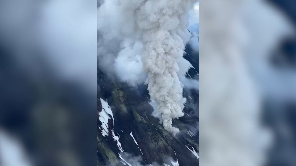
Rare eruption of the Krasheninnikov volcano in Kamchatka — the first in 500 years, Russia
The eruption of Klyuchevskoy — the highest active volcano in Eurasia — continues. On August 5 it released ash up to 7 km (4.3 miles) high, with the ash plume stretching nearly 500 km (310 miles). From the crater, lava flows almost continuously, while “volcanic bombs” — incandescent fragments of lava — are being ejected up to 500 m (1,640 ft) high.
At Shiveluch, Bezymianny, and Karymsky volcanoes, eruptions of different types and intensities continue.
Mutnovskaya Sopka is showing a thermal anomaly, confirmed by satellite images — it has been assigned a yellow aviation alert code. Strong seismic activity is being recorded at Kambalny volcano, while steam-and-gas emissions are observed at Avachinsky.
Local authorities and the Ministry of Emergency Situations have urged tourists and local residents to refrain from visiting areas within a 10 km (6.2 miles) radius of the summits of active volcanoes.
Indonesia
The Lewotobi Laki-laki volcano in Indonesia (East Flores Regency, East Nusa Tenggara Province) erupted twice within just a few hours.
On August 1 at 20:48 LT it ejected incandescent pyroclastic material and an ash column about 10 km (6.2 miles) high. The eruption was accompanied by flashes of volcanic lightning.
Less than 5 hours later, on August 2 at 01:05 LT, a second, even more powerful eruption occurred — the ash column rose 18 km (11.2 miles) above the summit.
Volcanic ejecta spread in all directions up to 4 km (2.5 miles) from the crater.
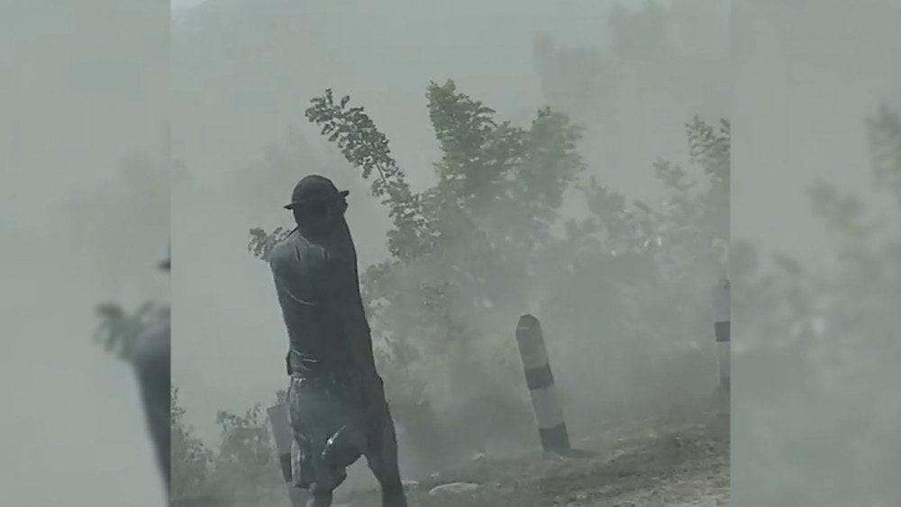
After the eruption of the Lewotobi Laki-laki volcano, surrounding areas were shrouded in a dense ash haze, Indonesia
During both eruptions, flames engulfed the summit, and a deep rumbling sound could be heard from as far as 20 kilometers 12.4 miles).
Hearing the powerful rumble, local residents ran out into the streets in panic. According to them, within just ten minutes, the roofs of houses were covered with a layer of ash, and the air was filled with a sharp smell of sulfur. A real “rain” of incandescent rock fragments fell on several villages.
Residents and tourists are urged not to approach the crater closer than 6 km (3.7 miles).
The Head of the Center for Volcanology and Geological Hazard Mitigation (PVMBG) of the Ministry of Energy and Mineral Resources (ESDM), Hadi Wijaya, emphasized that the nature of Lewotobi Laki-laki’s eruptions has changed: whereas previously they occurred about 4 hours after seismic signs appeared, now this interval has shortened to 2 hours, indicating a rapid rise of magma.
The same is happening with volcanoes around the world. Specialists are recording the ascent of hotter and more fluid magma to the surface, which is erupting not only from the magma chamber, as was usual, but also directly from the Earth’s mantle. Why this is happening is explained in detail in the report “On the Progression and Consequences of Climate Disasters.”
China
In many provinces of China, floods are raging again. According to official data, at the end of July torrential rains and their aftermath claimed the lives of at least 75 people, 44 of them in Beijing. In just a few days, almost a year’s worth of precipitation fell on the capital.
The hardest-hit area was Miyun — where up to 573.5 mm (22.6 in) of rainfall was recorded, while the average annual precipitation in Beijing is about 600 mm (23.6 in).
Local residents claim they did not receive timely warnings about the approaching threat. Many realized the scale of the disaster only upon waking around 4–5 a.m., when the water was already up to their knees.
The highest number of victims was in a nursing home. The water level there rose by more than two meters (6.6 ft), and many elderly people with limited mobility were unable to escape.
More than 80,000 people were evacuated from Beijing. Authorities admitted that the existing disaster prevention plans proved ineffective, and the city’s flood defense system against deadly floods has serious “gaps.”

Torrential rains hit China, triggering devastating floods
The downpours triggered not only floods but also landslides, leaving residents of several Beijing suburbs cut off from the outside world, and 136 villages without electricity. The disaster flooded homes, destroyed crops, and caused the death of poultry.
The total number of affected people exceeded 300,000.
According to the China Meteorological Administration, in recent years extreme floods in the country have become more frequent. This year the rainy season in northern China began unusually early, and the average rainfall has already exceeded the norm by almost 30%.
The example of the deadly flood in Beijing once again confirms: conventional response scenarios are no longer working — even in countries with highly organized and technologically equipped rescue services, such as China. The modern nature of natural disasters, their speed and unpredictability, demands a fundamental revision of all current standards and emergency response plans.
Australia
On July 31 in the northern areas of South Australia — in the Flinders Ranges region and the town of Andamooka — a severe hailstorm struck, surprising local residents and tourists. For this arid and hot area, such a phenomenon is rare and represents a climatic anomaly.
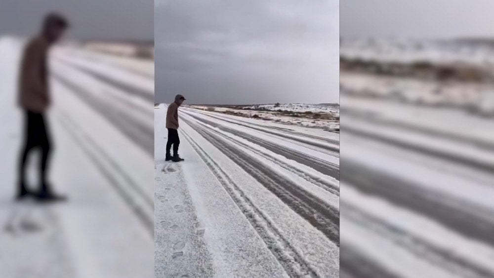
Icy cover in the desert — a rare climatic anomaly in Andamooka, Australia
The storm raged for about an hour and a half, covering the desert with a layer of ice. At the same time, temperatures dropped to 0 °C (32 °F), extremely low values for the region, where the average minimum temperature at this time of year is usually about +8 °C (46 °F).
Extreme weather conditions also developed in New South Wales. On August 2, record snowfalls occurred in the north of the state. In some areas, snow cover for the first time reached 40 cm (15.7 in). Residents were caught off guard, about 200 vehicles were stranded on the roads, some for several hours. According to meteorologists, not only the amount of snow was anomalous, but also the vast area affected by the snowfalls.
Strong winds on the Mid North Coast knocked down trees and tore roofs off buildings. More than 32,000 homes and businesses were left without electricity.
Throughout the state, floods, snow, and ice disrupted road and rail transport. One person went missing.
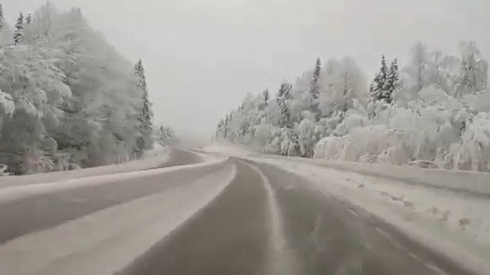
Anomalous snowfall hit New South Wales in Australia, bringing extreme weather conditions to the region
United Kingdom
On August 4, the rare and powerful summer storm Floris struck the north of the United Kingdom, affecting Scotland, parts of northern England, Northern Ireland, and northern Wales.
Wind gusts reached 160 km/h (99 mph), and in the Scottish mountains — up to 216 km/h (134 mph), levels that are almost unheard of at this time of year.
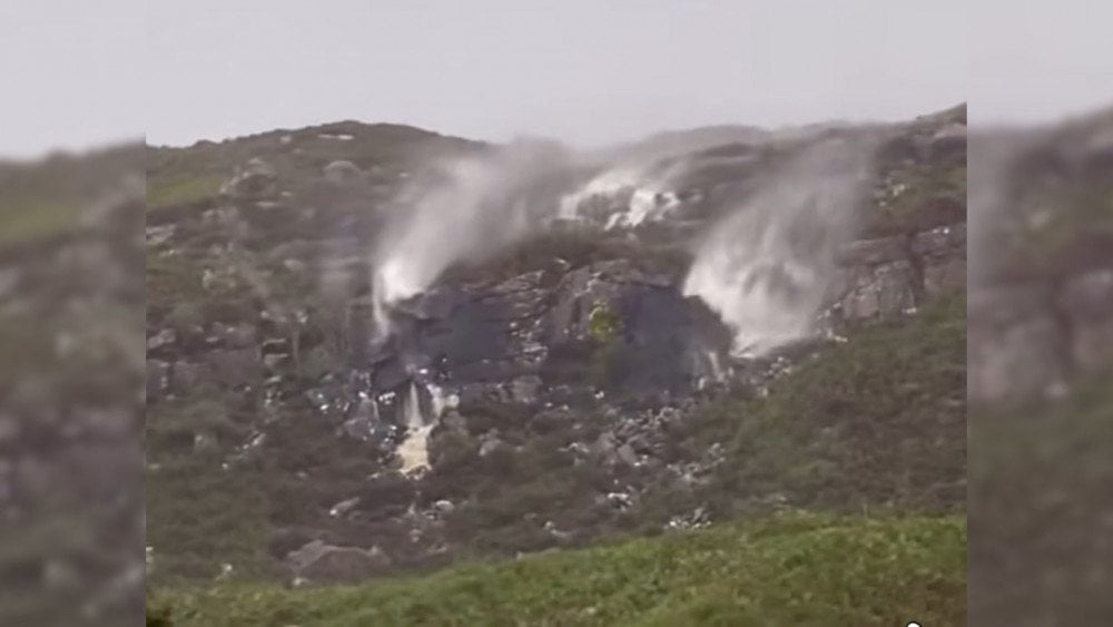
Strong winds during storm Floris created the effect of “flying waterfalls” in Scotland
Tens of thousands of homes were left without electricity, and repair efforts were hampered by severe weather — helicopters were required for assistance.
Storm-force winds toppled trees and power lines, blocking highways and key bridges across the Tyne and Forth rivers.
Rail operators had to reduce train speeds or completely halt services.
About 150 flights were canceled; two planes were unable to land in Aberdeen and returned to their departure points, flying almost 1,500 km (930 miles) in vain.
Ferry services on the west coast of Scotland were also halted, creating difficulties for tourists and local residents.
For the first time in 75 years, the famous Royal Edinburgh Military Parade was canceled.
Peru
Starting on July 31, several regions of Peru were engulfed by a massive sandstorm that covered Ica, Paracas, Nazca, and also affected Lima, Arequipa, and Tacna.
Winds of up to 50 km/h (31 mph) lifted thousands of tons of sand into the air, turning day into night. Visibility in the epicenter of the disaster dropped to 2 m (6.5 ft), completely paralyzing movement.
The Peruvian airline Corpac suspended flights over the Nazca Plateau geoglyphs, seaports and markets were temporarily closed, and traffic on highways was restricted.
One of the hardest-hit sectors was tourism, vital for the local economy. In Huacachina — one of the region’s main attractions — dune excursions were canceled. All paragliding flights were suspended, and access to the lagoon was blocked.
In Paracas National Park, winds reached 70 km/h (43 mph), causing serious damage to the natural environment and infrastructure.
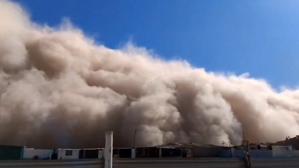
A powerful sandstorm covered Peru, lifting thousands of tons of sand into the air
In the provinces of Tacna and Arequipa, sand buried hundreds of hectares of corn ready for harvest.
And in the province of Caylloma, the storm damaged rice fields, putting the October and November harvest at risk.
Due to the high concentration of suspended dust and sand particles, breathing problems arose, especially among children, the elderly, and people with chronic illnesses.
This storm was the result of a rare combination of two types of winds — descending and horizontal. Although wind phenomena are common in the desert areas of Peru, the scale and intensity of this storm were exceptional and uncharacteristic for this time of year.
Russia
At the beginning of August, Russia was struck by a wave of extreme weather.
On July 31 in the town of Tyrnyauz, Kabardino-Balkaria, a powerful mudflow descended — the second in just 10 days. Masses of mud and stones rushed along the Gerkhozhansu riverbed. The main flow passed through a special mudflow diversion channel, but the volume of water and debris was so great that tons of mud overflowed the channel and flooded the streets.
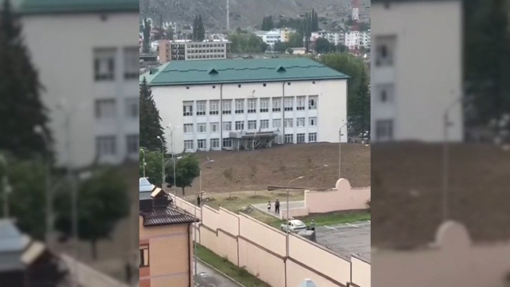
Mudflow flooded the streets of Tyrnyauz, Kabardino-Balkaria, Russia
A gas pipeline and power lines were damaged, about 3,000 people were left without water. Residential houses and city infrastructure were affected, roads were blocked. More than a thousand residents and tourists from the “Elbrus” resort were evacuated.
A rare phenomenon for Karelia — a waterspout — was observed on August 2 over Lake Ladoga. The funnel formed near the village of Ilyinsky and moved along the shore for several minutes.
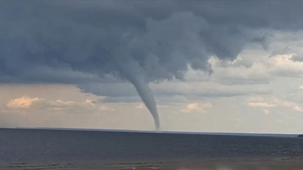
A waterspout, rare for northern latitudes, near the shores of Karelia, Russia
Such vortices are usually typical for tropical and subtropical latitudes, since their formation requires a combination of specific factors.
A waterspout forms under a combination of several conditions: warm water, high humidity, atmospheric instability, and the passage of a cold front.
Exactly these weather conditions developed in the region at the end of July: air temperature exceeded the norm by 7–9 °C (12.6–16.2 °F), and the water temperature in Lake Ladoga reached an anomalous +23 °C (73 °F).
On August 3 in Smidovichsky District of the Jewish Autonomous Region, a massive tornado occurred — an extremely unusual phenomenon for this area. The powerful vortex broke several power line supports, leaving several settlements without electricity.
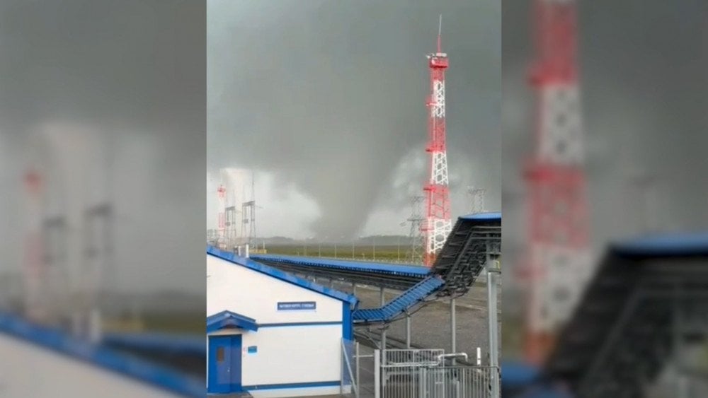
An unusual phenomenon for the region — a powerful tornado in Smidovichsky District of the Jewish Autonomous Region, Russia
On August 3, heavy rains struck Krasnodar Krai. In some areas more than two monthly rainfall norms fell: in the village of Kichmay — 171 mm (6.7 in) (while the average monthly norm for August is 81 mm / 3.2 in).
The Tuapse district was hit hardest, where a state of emergency was declared.
Due to the torrential rains, the level of mountain rivers rose sharply: homes and yards in several settlements — the villages of Moldovanovka, Defanovka, Fanagoriyskoye, and the settlement of Novomikhailovsky — were flooded.
Floodwaters carried dozens of boats and yachts out to sea.
In the village of Lermontovo, the metal bridge across the Shapsukho River was washed away. About 300 houses were cut off from the outside world.
In the village of Defanovka, a bus carrying 25 workers fell into the river. Fortunately, the people were rescued.
On the beach of the village of Agoy, a waterspout came ashore. The vortex lifted into the air bungalows, sun loungers, and a pedal boat, which crashed onto a canopy with people beneath it. There were no casualties.

Waterspout lifted a pedal boat into the air on the beach of Agoy, Krasnodar Krai, Russia
Torrential rains triggered a mudflow that swept onto the federal M-4 ‘Don’ highway, temporarily shutting down traffic.
Near the village of Fanagoriyskoye, the Chepsi River overflowed, causing part of an automobile bridge to collapse. As a result, 130 tourists were stranded on the opposite shore and had to be evacuated.
In the village of Shirokaya Shchel, heavy rains washed away the tent camp of the All-Russian children’s center “Orlyonok.” About 60 children and counselors were inside when the floodwaters struck suddenly. Panic broke out, but everyone was safely evacuated. Fortunately, there were no serious injuries — only minor bruises and scratches.
On August 2, a powerful storm struck the city of Arzamas in Nizhny Novgorod Oblast. In a single day, 110 mm (4.3 in) of rain fell — nearly two monthly norms (the average monthly norm for August is 60 mm / 2.4 in).
Roads turned into real rivers. Cars were submerged. Widespread flooding of houses was recorded.
Winds with gusts of 25 m/s (56 mph) toppled trees, damaged roofs and building facades, power and communication lines. More than 7,000 people were left without electricity.
The dispatch center in the city hospital was also cut off, disrupting ambulance operations.
Day after day we witness the same picture — record-breaking floods, extreme temperature anomalies, intensifying winds, destructive storms, and escalating seismic and volcanic activity. All of these are not isolated events, but manifestations of a single global process our planet is undergoing. We have spoken about this many times before, and will return to it again. But today, let’s focus on the most alarming sign.
The M8.8 mega-earthquake in Kamchatka has become a stark symptom of large-scale geodynamic changes — something ALLATRA scientists have long warned about.
What we are seeing is not simply the activity of the Pacific Ring of Fire, but the result of immense pressure created by a giant magma plume — a vast upwelling of incandescent material rising from the Earth’s depths beneath Siberia, with its epicenter near Norilsk.
The impact of the plume does not cause sharp local deformations of the Earth’s crust in one point. Instead, an overall uplift of the entire Siberian crustal block is being recorded, including the West Siberian Plate, the East Siberian Craton, and the Verkhoyansk-Chukotka Fold System. It is precisely this large-scale, though relatively slow, process that generates colossal stress along the edges of the continental block. As a result, its outer boundaries literally begin to oscillate — and it is along these edges that the most intense geodynamic events unfold.
This phenomenon is called ‘edge effects,’ and they are already being recorded along the entire perimeter of the block — in the Urals, in the region of Lake Baikal, the Verkhoyansk Range, the Kuril-Kamchatka region — and they will only intensify.
Therefore, the powerful earthquake in Kamchatka is not the end. It is only the beginning. And the next catastrophe may occur where it is least expected.
Meanwhile, the scientific community — particularly in Russia — continues to deny the obvious, assuring society that “everything is under control.” Their views are presented in the media as the ultimate truth, even though they often lack serious analysis or verification from other disciplines.
Another widely circulated claim is that the M8.8 earthquake supposedly “discharged” the tectonic plates, meaning no major seismic events should be expected for years or even decades.
But this earthquake followed a different mechanism, and therefore the chain of events will unfold differently.
If timely measures are not taken for planned degassing of the source — the Siberian magma plume — then within just five years, earthquakes comparable to Kamchatka’s will begin striking around the globe once a week. At the same time, volcanic activity will transform: magma will rise from much deeper sources, making eruptions far more unpredictable and destructive.
Draw your own conclusions…
You can watch the video version of this article here:
Leave a comment