Summary of Climate Disasters on the Planet: November 20-26, 2024
Warm air rapidly surged from the Atlantic into Europe and reached the Arctic Ocean, causing mighty chaos in the atmosphere: storms, abnormal precipitation, and temperature swings.
France
On the night of November 21, Storm Caetano swept across France from west to east, marking an unusually early and severe start to winter. Temperatures dropped to levels typical for January. In the municipality of Bourdons-sur-Rognon, the temperature fell to -10.8 °C (14 °F). Heavy snowfalls were recorded across the country.
In Paris, snowfall of such magnitude hadn’t been observed for 56 years. The Eiffel Tower was closed to visitors due to snow accumulation. In the commune of Montmorency-Beaufort, 31 cm (12.2 inches) of snow fell.
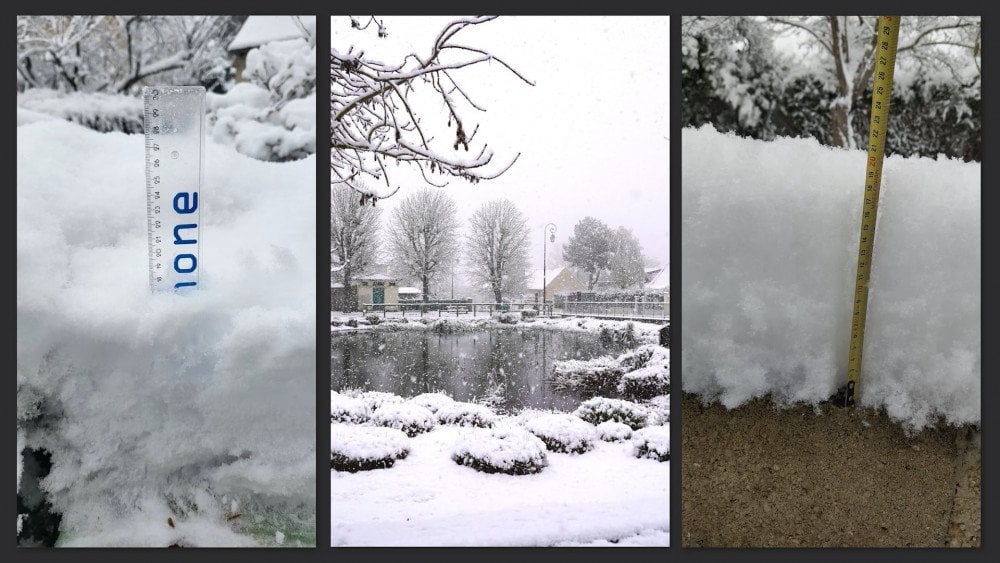
Record-breaking snowfalls hit France
The storm also brought strong winds to the French Atlantic coast: on Groix Island, wind speeds reached 162 km/h (101 mph); at Pointe de Chemoulin, winds were recorded at 154 km/h (96 mph). Severe weather left 250,000 households without electricity, with Normandy and the Loire Valley being hit the hardest.
About 5,000 vehicles were stuck on highways. Dangerous road conditions resulted in a massive accident near Paris, injuring 36 people. Ferry operator DFDS canceled crossings in the English Channel due to strong winds.
Railway service was interrupted. Hundreds of passengers were stuck in two trains for nine hours due to power outages.
Germany and Switzerland
On November 21–22, Germany and Switzerland were hit by low temperatures and heavy snowfalls.
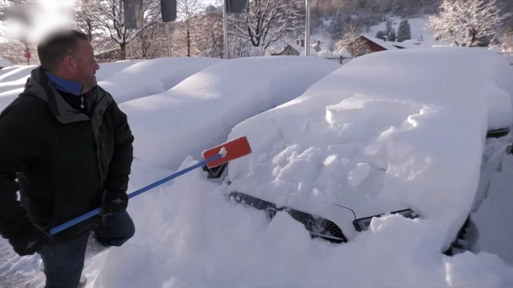
Heavy snowfall buries cars in Germany
In Konstanz, Germany, 15 cm (5.9 inches) of snow was recorded—more than usually fell in the entire month of November over the last 50 years.
In Switzerland, record-breaking snowfall of over 25 cm (9.8 inches) fell in Zurich and Basel. In Lucerne, 42 cm (16.5 inches) of snow was recorded, breaking a 100-year-old monthly record. The previous record—28 cm (11 inches)—was set in November 1919.
However, just two days later, the snow disappeared, giving way to summer-like weather. In Karlsruhe, Germany, the frost of -4 °C (24.8 °F) suddenly turned into +19 °C (66.2 °F). Such warm temperatures are more typical of May than November when the average maximum does not exceed +8 °C (46.4 °F). On November 25, records for both minimum and maximum temperatures were broken in Baden-Baden. Daytime temperatures reached 22.3 °C (71.6 °F)—the highest for November since measurements began. Nighttime temperatures did not fall below 17.5 °C (62.6 °F), exceeding even July averages (average July nighttime temperature is 13 °C / 55.4 °F). Nighttime records were also broken at more than 30 stations in Germany.
United Kingdom
On November 23, Storm Bert struck the United Kingdom, becoming one of the most destructive storms over recent years. The country experienced torrential rains and winds reaching speeds of up to 132 km/h (82 mph).
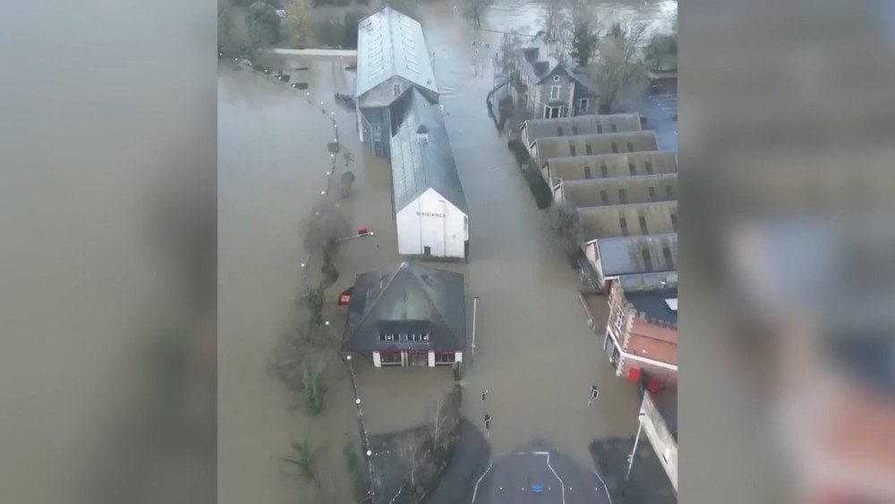
Storm Bert caused severe flooding in the United Kingdom
In Worcestershire, England, the River Caire Brook breached a protective wall and flooded a market town to depths of up to 4 meters (13 feet). Dozens of shops and businesses were affected, with broken windows and significant damage to infrastructure.
In Northampton, England, a leisure park was flooded for the third time this year due to river overflow. Around 1,000 people had to be urgently evacuated.
At London Heathrow Airport, about 1,500 flights were canceled or delayed. Railway services were also disrupted. Widespread power outages occurred across England and Scotland. At least five people lost their lives in the United Kingdom as a result of the storm.
Ireland
In Ireland, storm Bert caused damages estimated in millions of euros. More than 60,000 homes and businesses were left without power, and over 100 roads were flooded. The counties of Cork, Kerry, Galway, Limerick, and Donegal were hit the worst. In the town of Listowel, Kerry County, the River Feale overflowed, reaching record levels, and caused evacuation of more than 100 people.

Aftermath of Storm Bert in Ireland
Türkiye
Starting November 23, Türkiye faced a powerful snowstorm. Severe blizzards resulted in school closures across 32 provinces and the evacuation of more than 2,000 people.

Massive snowfalls caused chaos on Türkiye's roads
Temperatures dropped by 15–18 °C (59–64 °F), and snow in mountainous areas reached depths of 50 cm (19.7 inches).
Heavy snow paralyzed traffic on key highways and other roads across the country. Drivers were forced to wait for hours for rescue services.
The storm resulted in two fatalities, and many people narrowly escaped with their lives. Four hunters were rescued two days after being trapped in snow, and an elderly couple was found freezing near a tree. They got lost on their way home and couldn’t keep walking due to the blizzard. They survived by keeping warm with lambs they carried with them.
The day before, on November 22, Türkiye was hit by heavy rains and hurricane-force winds.

Flooded urban streets in Türkiye
In the city of Ortaca, Muğla Province, 149.3 mm (5.87 inches) of rain fell within 24 hours.
Tornadoes in parts of Antalya Province destroyed farming greenhouses and damaged agricultural products.
In Istanbul, heavy rainfall and wind caused trees to fall on roads, and pieces of roofs were blown off buildings, which caused transport disruptions. Some airplanes arriving at Istanbul Airport were unable to land due to powerful crosswinds. After several failed attempts, they were rerouted to other airports.
Iceland
On the Reykjanes Peninsula, a new eruption occurred in the Sundhnúkur crater row on November 20 at 11:14 PM local time.
The fissure from where magma erupted stretched to 3 km (1.9 miles). Lava moved more slowly than during the previous eruption, but spread over a larger area.
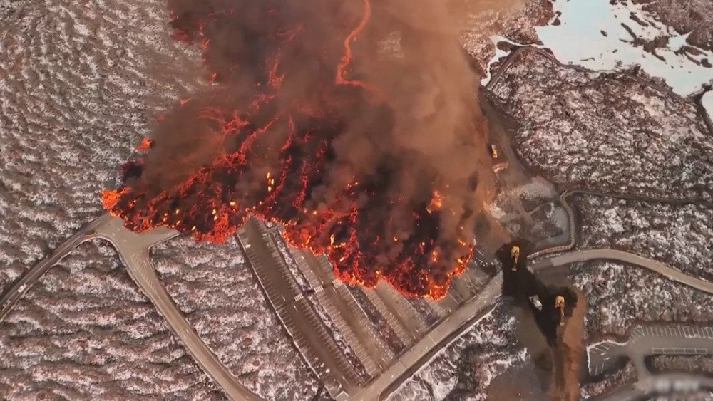
Volcanic eruption on Reykjanes Peninsula, Iceland
Lava flows engulfed a parking lot and service buildings at a popular tourist resort, Blue Lagoon. The main threat loomed over pipeline systems and energy facilities in the Svartsengi area.
Lava reached embankments built to protect critical infrastructure and started spilling over them. Emergency services and engineers worked urgently to raise the embankments to 4 meters (13 feet) and reinforce pipelines. Twelve powerful water cannons were installed on top of the embankments to cool the lava flows and slow their advance.
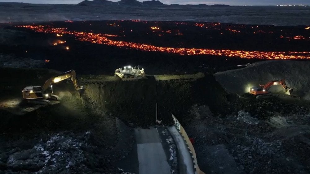
Emergency services fortifying embankments to protect critical infrastructure from lava flows on the Reykjanes Peninsula, Iceland
It has been the sixth eruption this year and the tenth since the volcano’s reactivation in March 2021, following an 800-year period of dormancy.
Experts have been alarmed by the sudden onset of the eruption, as there was no prior increase in seismic activity, typical of earlier events.
United States and Canada
A “bomb cyclone” struck the Pacific coast of the United States and Canada. Meteorologists described this storm as one of the most intense ever recorded in the region, surpassing twofold the threshold required for classification as a “bomb cyclone.”
On the night of November 20, wind gusts exceeding 160 km/h (99 mph) were recorded on Vancouver Island in Canada, equivalent to a category 2 hurricane. In British Columbia, approximately 140,000 customers were left without power.
In Washington State, USA, winds gusts up to 112 km/h (70 mph) toppled numerous trees that damaged vehicles and roofs and caused at least two deaths.
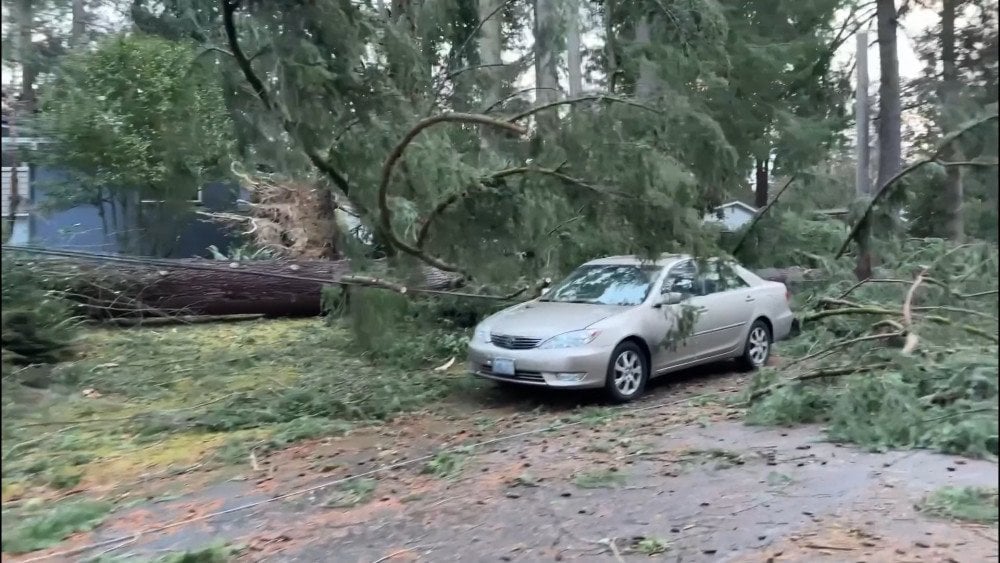
Hurricane-force winds toppled trees and damaged vehicles in Washington State, USA
700,000 homes and businesses were left without power. The cyclone caused massive waves at sea, reaching up to 10 meters (33 feet) in height.
The situation was aggravated by the simultaneous impact of an atmospheric river.
When a bomb cyclone interacts with an atmospheric river, they intensify each other manyfold. A powerful atmospheric river supplies moisture to the low-pressure system, fueling a cyclone. As the low-pressure system intensifies, it further strengthens the atmospheric river.
This kind of combination makes the weather even more unpredictable and hazardous. Chad Hecht, a meteorologist from the University of California, San Diego, compared the result of the superposition of these natural phenomena to an out-of-control firehose.
The atmospheric river delivered extreme amounts of rain and snow to California and Oregon.

Heavy snowfalls hitting California, USA
Blizzards resulted in partial closure of Interstate 5, the main highway along the US West Coast. Over several days, some areas of Northern California received more than 380 mm (15 inches) of precipitation, amounting to nearly 40% of the annual norm.
Fortunately, this powerful storm occurred early in the season when the soil was still dry and able to absorb moisture, reducing the risk of catastrophic flooding.
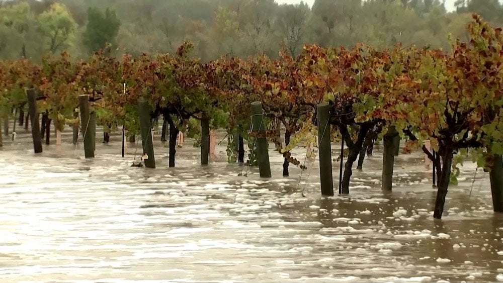
Extreme precipitation caused orchard flooding in the USA
Natural phenomena that used to adhere to predictable seasonal rhythms are losing their stability. The atmosphere is becoming chaotic and unpredictable.
This raises a logical question: what is driving these alarming processes, and why is nature exhibiting such extremes?
Years of research by independent scientists have shed light on an unexpected cause of climate chaos. It originates from the ocean and a mysterious “Factor X” that has previously gone unnoticed by modern climate models.
At the COP16 conference, a documentary film on this research was premiered with a presentation of an innovative approach to restoring climate system stability. We invite you to watch this film and share the information with others to raise awareness about the challenges faced by the planet and potential solutions to the climate crisis.
Watch the video version of this article here:
Leave a comment